


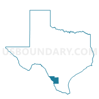
Voting District 0236, Webb County, Texas
About
Outline

Summary
| Unique Area Identifier | 678083 |
| Name | Voting District 0236 |
| County | Webb County |
| State | Texas |
| Area (square miles) | 247.35 |
| Land Area (square miles) | 247.31 |
| Water Area (square miles) | 0.03 |
| % of Land Area | 99.99 |
| % of Water Area | 0.01 |
| Latitude of the Internal Point | 27.36831150 |
| Longtitude of the Internal Point | -98.96628730 |
Maps


Graphs
Select a template below for downloading or customizing gragh for Voting District 0236, Webb County, Texas


Neighbors
Neighoring Voting District (by Name) Neighboring Voting District on the Map
- Voting District 0002, Jim Hogg County, TX
- Voting District 0002, Zapata County, TX
- Voting District 0006, Duval County, TX
- Voting District 002A, Zapata County, TX
- Voting District 0227, Webb County, TX
- Voting District 0237, Webb County, TX
- Voting District 0238, Webb County, TX
Top 10 Neighboring County Subdivision (by Population) Neighboring County Subdivision on the Map
- Laredo South-El Cenizo CCD, Webb County, TX (67,228)
- Zapata CCD, Zapata County, TX (13,115)
- North Jim Hogg CCD, Jim Hogg County, TX (5,217)
- San Ygnacio CCD, Zapata County, TX (903)
- Realitos-Concepcion CCD, Duval County, TX (893)
Top 10 Neighboring Place (by Population) Neighboring Place on the Map
- Bruni CDP, TX (379)
- Mirando City CDP, TX (375)
- Oilton CDP, TX (353)
- Thompsonville CDP, TX (46)
- Aguilares CDP, TX (21)
Top 10 Neighboring Unified School District (by Population) Neighboring Unified School District on the Map
- Zapata County Independent School District, TX (14,018)
- Jim Hogg County Independent School District, TX (5,300)
- Benavides Independent School District, TX (2,211)
- Webb Consolidated Independent School District, TX (1,323)
Top 10 Neighboring State Legislative District Lower Chamber (by Population) Neighboring State Legislative District Lower Chamber on the Map
Top 10 Neighboring State Legislative District Upper Chamber (by Population) Neighboring State Legislative District Upper Chamber on the Map
Top 10 Neighboring 111th Congressional District (by Population) Neighboring 111th Congressional District on the Map
Top 10 Neighboring Census Tract (by Population) Neighboring Census Tract on the Map
- Census Tract 9504, Zapata County, TX (5,610)
- Census Tract 9505, Duval County, TX (3,178)
- Census Tract 9504, Jim Hogg County, TX (3,037)
- Census Tract 18.15, Webb County, TX (1,730)
- Census Tract 18.13, Webb County, TX (944)